Maps
Viewing Info
You can click here to see the image without the viewer at the largest size possible for your monitor.
Navigation Info
Grouped Material: View Photos - Howe Truss Bridge over the Pembina River at ManolaView Figures - Time Table Supplement, Barrhead Subdivision , October 17, 1927
Go to: Maps
Text
Photos
Sidings

Pembina Valley Railway

Powered by Zoomify
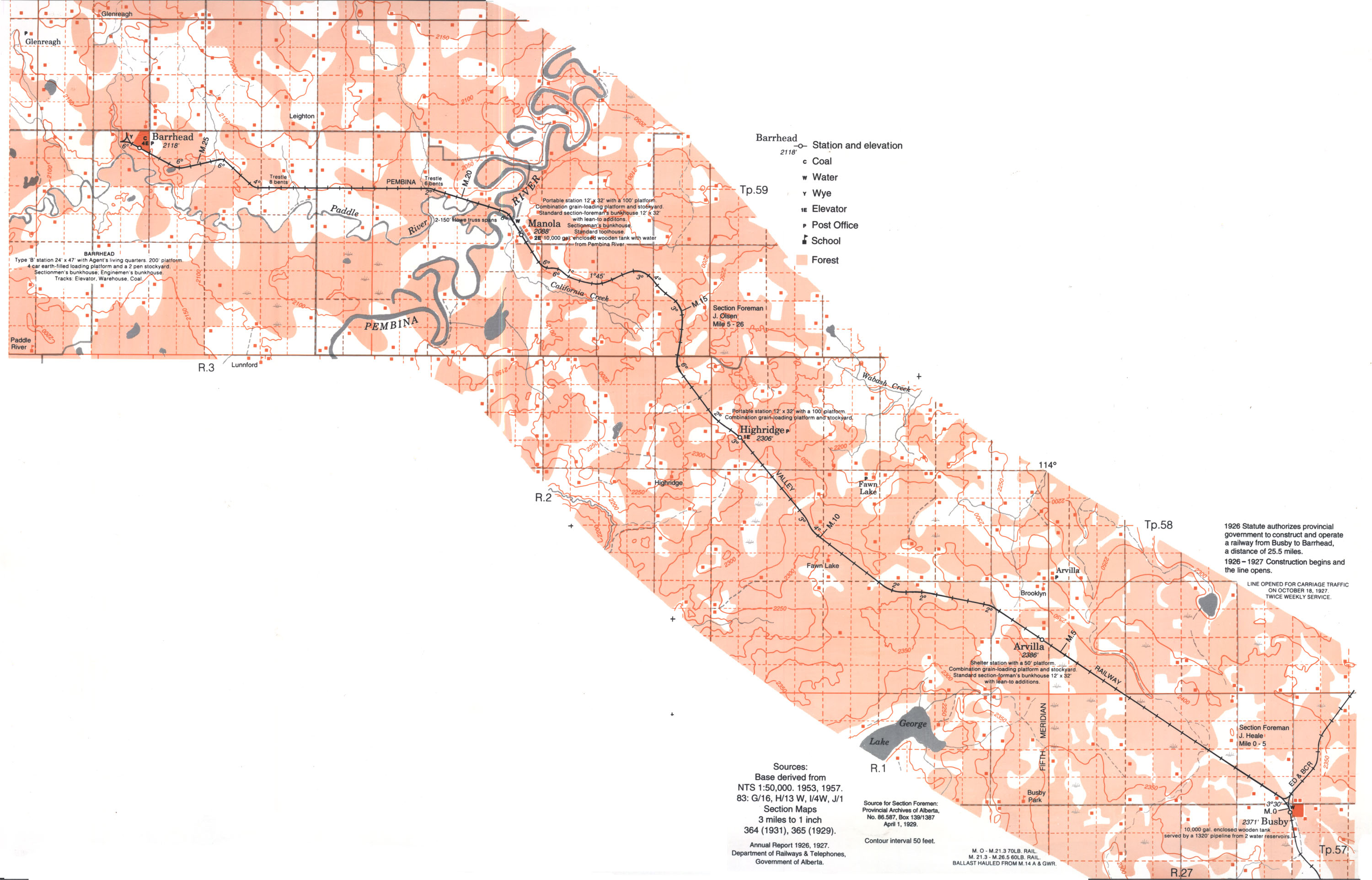
Source: Base derived from NTS 1:50,000. 1953, 1957. 83: G/16, H/13, I/4W, J/1. Section Maps 3 miles to 1 inch 364 (1931), 365 (1929). Annual report 1926, 1927. Department of Railways & Telephones, Government of Alberta. Source for Section Foremen: Provincial Archives of Alberta, No. 86.587, Box 139/1387 April 1, 1929. Contour interval 50.